


3 Best Utah Spring Break Backpacking Trips
Southern Utah has the most stunning canyons in the world. For spring break trips, Capitol Reef, Coyote Gulch, and the longest slot canyon in the world become prime destinations for backpacking trips to beat the winter blues!
| Trip | Difficulty | Days | Miles |
| CAPITOL REEF | Strenuous | 5-6 | 32 |
| PARIA CANYON | Strenuous | 5 | 31+ |
| COYOTE GULCH | Moderate | 4 | 26 |
1. Capitol Reef, Water Pocket Fold
The Area
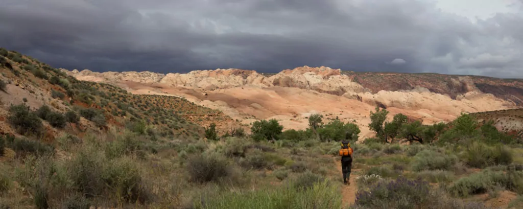
Sixty-five million years ago, the same compacting forces that created the Rocky Mountains formed a fold in the earth under southern Utah. Less than a century ago, that tangle of crevices, canyons and chasms became the last-mapped landscape in the lower 48. Rich in wilderness and history, this is country that hid Mormon moonshiners, polygamist safe houses and Butch Cassidy. And even today it feels a step from the edge of the earth. Capitol Reef is a Gold-Tier International Dark Skies Park, making it one of the best places in the world to view the stars and Milky Way.
Trip Overview
Visit one of the only double arches in the world before taking a unique hike through a slot canyon with virtually no visitors other than yourselves. Skirt the Waterpocket Fold and visit the iconographic but hidden Hamburger Rocks, then visit Lower Muley Twist through its namesake canyon.
Getting There
Check conditions of Notom-Bullfrog and Burr Trail roads before going.
Road Conditions Resources
– Anasazi State Park in Boulder, UT: 435-335-7308
– Capitol Reef Visitors Center in Fruita, UT: 435-425-3791
Access Lower Muley Twist TH via the Burr Trail Road east of Boulder, UT. Halls Creek Overlook trailhead is off the Notom-Bullfrog Rd, which runs north/south between the Waterpocket Fold and the Henry Mountains.
From Salt Lake City, UT: 5.5 hours
Take I-15 South to US Hwy 50. Continue on UT 24 to access UT 12 and the Burr Trail via Torrey and Boulder, where you’ll connect with the Burr Trail Road.
From St. George, UT: 5.5 hours
Take I-15 North to UT 20. Head east on UT 20 to HWY 89. Take HWY 89 south to UT 12, then follow UT 12 to Boulder, where you’ll connect with the Burr Trail Road.
From Las Vegas, NV: 7.5 hours
Take I-15 North for two hours and join directions from St. George above.
Recommended Day by Day Itinerary
Lower Muley Twist TH to Halls Creek Overlook TH, via Halls Creek Narrows
Day 1: Enter Lower Muley Twist TH. Short hike with impressive canyon walls through most of the day. Plan to Dry Camp as there are no reliable water sources in Lower Muley. Potential water options within the Lower Muley Canyon are at the following coordinates: 37.760455, -110.983039, and 37.790714, -110.994216. Total hike is 3.3 miles, ~700 feet gradual elevation loss.
Day 2: Sandstone walls top out at 1000′. Explore multiple Alcoves, including “Cowboy Cave,” which has lots of pioneer graffiti. Terrain is gradual decline for most of the day. Exit the bottom of Lower Muley Twist Canyon towards the end of the day. Option to camp near Hamburger Rocks or near Brimhall Arch; both have water sources. Total hike is 4-7 miles, ~800 feet elevation loss.
Day 3: Lots of miles today but easy, fast-moving terrain. Essentially, continue down the Halls Creek Drainage to in the vicinity of Fountain Tanks. You’ll be walking along the Waterpocket Fold the entire day. Total hike is ~7-10 miles, 600 feet elevation loss.
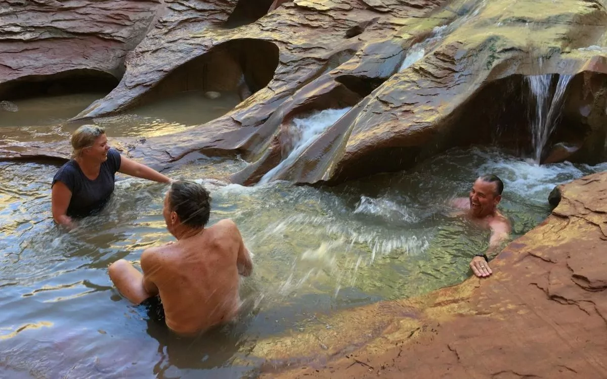
Day 4: Day hike loop of Halls Creek Narrows > return to camp with options to layover or to pack-up and continue up-canyon towards Fountain Tanks. Comparable in size and scope to the Virgin River Narrows in Zion National Park, Halls Creek Narrows is one of the most stunning canyon narrows sections on the Colorado Plateau. Total hike is 5.5-9 miles, nominal feet elevation change.
Day 5: Today’s hike is straight up the Halls Creek Drainage. You’ll be following the 1881 wagon route designed by Charles Hall as be an alternative to Hole In The Rock Road, and pass by Red Slide (500′ slide coming off the Fold) and explore a side canyon in-route. Total hike is 4-8 miles, 400-600 feet elevation gain.
Day 6: Start your day with a short hike up the Halls Creek watershed from camp. Then day hike out-and-back to Brimhall Arch, and end with an 800′, 1.2-mi (at times steep) ascent from the Halls Creek drainage. Total hike is 3-5 miles, 900 feet elevation gain.
Permits, Fees, Reservations…etc.
Backcountry permits are required. These are free, and can be picked up at the National Park Visitors Center in Fruita, UT or Anasazi State Park in Boulder, UT.
- Capitol Reef National Park Visitors Center is open daily with exceptions for some holidays. 435-425-3791
- Anasazi State Park (convenient if arriving from St. George and points west) is generally open year round, seven days a week (some holiday closures). 435-335-7308
You can find all backcountry regulations on the Capitol Reef park website. See also, Capitol Reef backcountry route information and resources.
When to do this Trip
Ideal times of year to complete this backpacking trip in Capitol Reef National Park are both as a spring break trip, and in the fall. Best date windows, based on historical data, are March 15 – May 1 and September 15 – November 1.
For current conditions, see weather at Lower Muley Twist. We also strongly recommend you call the visitor center (information above).
Campsites
One of the great things about backpacking in Capitol Reef is that you are not limited or restricted to designated backcountry campsites; camping in the backcountry is at-large. Your major considerations when selecting a backcountry campsite are proximity to water, impact on the environment (LNT) and your own safety.
Here are some backcountry campsites that we recommend on this route.
Night 1: Lower Muley Twist Canyon near jct w/ Cutoff Tr. (ca. 4964′)
Night 2: near Muley Tanks / Hamburger Rocks (ca. 4613′)
Nights 3 & 4: before Halls Divide (ca. 4160′)
Night 5: Grand Gulch (Halls Creek) south of jct w Halls Creek Overlook Tr (ca. 4416′)
Hike Capitol Reef with a Guide
Guided Capitol Reef backpacking trips are available, and are a stress-free, exciting way to do this trip. The tour company handles permits, gear, transportation, meals, and provides a professional guide so you can focus 100% on enjoying your adventure. Read more…
All-inclusive Utah Backpacking Adventures
2. Paria Canyon Through-hike
The Area
Paria (pronounced Purr-eee-ah) is a Paiute word describing the river as muddy or silty. This 40-mile wilderness canyon connects the southern end of Grand Staircase-Escalante National Monument to the northern end of the Grand Canyon (it ends where the Grand Canyon Rafting Trips begin).
Trip Overview
Imagine hiking Zion Canyon from the Narrows to the Visitors Center and beyond. Now imagine that canyon looked like it did in 1849 when the first white settlers came to the region. That’s as close-a-description as you can get to hiking from Paria Canyon to Lees Ferry. This 5-day through-hike treks beneath Zion-scale sheer canyon walls (the tallest in the world) without the cars or crowds contained in a National Park.
Getting There
You’ll start your hike at White House Trailhead, east of Kanab, UT; and conclude at Lees Ferry, west of Paige, AZ.
From St. George, UT: 2.25 hrs
Head towards Kanab, UT via Colorado City, AZ on UT-9, AZ-389 and (north on) HWY 89A. Head East in Kanab on HWY 89. The turnoff for the trailhead is 43 miles east of Kanab on HWY 89. The dirt road to the trailhead is on the south (right) side of the highway.
From Flagstaff, AZ: 2.5 hrs
Take HWY 89 north via Paige, AZ and Big Water, UT. The turnoff for the trailhead (on your left) is 15.5 miles west of Big Water. (Note: last substantial services are in Paige.)
From Salt Lake City, UT: 6 hrs
Take I-15 south (ca. 215 miles) to UT-20. Go east on UT-20 to HWY 89, and take HWY 89 south to Kanab. Follow directions from Kanab (from St. George) above.
Recommended Day by Day Itinerary
Day 1: The first day’s hike takes you down the Paria River drainage towards your campsite at the intersection of Paria and Buckskin gulch. The trail begins in a wide wash. Expect the wash to either be dried up mud or wet. If wet, the mud can be very slick. As you hike further downstream the trail narrows as you enter the narrow parts of Paria Canyon. Depending on previous weeks’ rainfall there can be water while hiking that varies widely. Terrain is totally flat. Total hike is 7.5 miles, minimal feet elevation loss.
Day 2: Take a day hike up Buckskin Gulch (the longest slot canyon in the world!) before packing up camp and continuing down the Paria. Big Spring is your next available campsite (river mile 12). Others exist further along as well; the campsite at river mile 14.7 is really wonderful. Do get water at Big Spring as your next available spring is at mile 18.4. Total hike is 5-8 miles, minimal feet elevation loss.
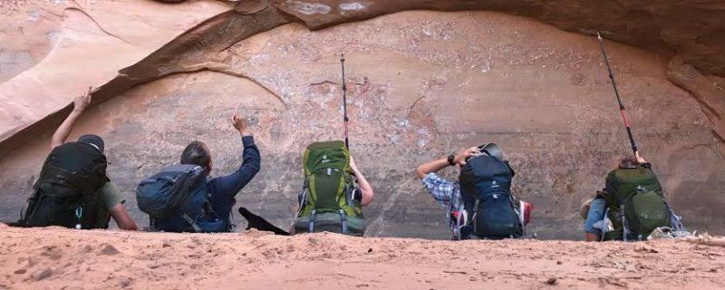
Day 3: You’ll get late sun in the morning thanks to incredibly tall canyon walls. Continue down river and plan to camp at one of the three springs between river miles 20 and 23. Enjoy numerous opportunities for side hikes up various feeder canyons. We strongly recommend taking the short walk up Wrather canyon for views of one of the most impressive natural arches in Arizona. Another recommended side hike is the impressive KeyHole slot. Total hike is 7-10 miles, minimal feet elevation change in the river and uphill in the side canyons.
Day 4: The Paria River is an impressive canyon carving machine. By river mile 22, it has dug through nearly 1000 feet of the Navajo sandstone (the premiere layer in Zion National Park). At Shower Spring, the even more erosion resistant Kayenta Formation begins to be exposed. Your hike will continue through several more rock layers giving a “canyon within a canyon” feel. Then the river reaches the Chinle formation, a soft shale eroding out from under the sandstones above it. The river bed becomes choked with huge boulders and you’ll eventually leave it for terrace on its west side. The terrace gives you a sweeping view of the canyon through to echo peak, 11 miles away. Camp tonight, under some cottonwood trees by the side of the river, and watch sunset on the high cliffs.. Total hike is 8-10 miles, ~200 feet elevation gain and loss over the terrace.
Day 5: There is no escaping the heat of the Arizona desert today. The canyon has widened to the point that shade from the cliff walls is few and far between. So an early start is a necessity. As the trail continues its gradual decent, the river crossing get farther apart. Keep your eyes open for California Condors and desert big horn sheep, both species which were successfully reintroduced here. Eventually, you’ll arrive at the Lonely Dell Ranch, Lee’s ferry, and the mighty Colorado River. Total hike is 5-7 miles, minimal elevation loss.
Permits, Fees, Reservations…etc.
Backcountry permits are required for Paria Canyon, which is protected in Vermillion Cliffs National Monument and administered by the Bureau of Land Management. Limit 20 hikers entering the canyon per day (from any trailhead).
You can reserve a backcountry permit up to four months from the month that your trip starts. So, for example, for a trip starting anytime in the month of May, you’d be able to reserve that permit on February 1 at 12:00pm Mountain Time.
Permits are non-refundable.
Warning: May and June permits can sell out in a matter of minutes.
When to do this Trip
The Paria river draws a massive watershed to the north, including Bryce Canyon. So precipitation up in Bryce can send a flash flood tumbling down through the Paria Canyon Narrows.
The combination of dry conditions (i.e. low flash flood potential) and mild temps make May the most popular month to hike in Paria Canyon. The first half on June is also great. And while monsoons are uncommon the entire month, late June can leave you with sweltering temps on the final day’s hike into Lonely Dell Ranch.
In the fall, September though mid-October are also pretty ideal = low flash flood potential + mild temperatures.
Campsites
The most important thing to consider when selecting a campsite in Paria Canyon is safety from the threat of advancing waters. The excellent publication “Hiker’s Guide to Paria Canyon,” put out by the BLM, provides detailed, mile-by-mile suggestions for safe (elevated) places to camp, as well as locations of springs and other features such as petroglyphs.
Here are our suggested campsites, based on the itinerary above.
Night 1: Paria/Buckskin Confluence
Night 2: Big Spring (river mile 12) or excellent camping at river mile 14.7 (fill up with water at Big Spring)
Night 3: River mile 22 near Shower Spring
Night 4: Several good campsites between river miles 30 and 33.5. (note, last reliable spring, named “Last Reliable Spring” is just past river mile 25)
Hike Paria Canyon with a Guide
Guided Paria Canyon backpacking trips are available, and are a stress-free, exciting way to do this trip. The tour company handles permits, gear, transportation, meals, and provides a professional guide so you can focus 100% on enjoying your adventure. Read more…
Award Winning USA Hiking Vacations
3. Coyote Gulch Backpacking Trip
The Area
In the southern Escalante Canyon system in Glen Canyon National Recreation Area, Coyote Gulch give you a glimpse of what Glen Canyon was like before being flooded by Lake Powell. Highlights include beautifully sculpted streambeds, intimate cascades and waterfalls, deep overhangs and alcoves, and numerous natural bridges and arches.
Trip Overview
You can access Coyote Gulch from four different trailheads. Lots of folks choose to access Jacob Hamblin Arch and Coyote Natural Bridge (two of the Gulch’s more iconographic sights) from Hurricane Wash or Jacob Hamblin Arch TH.
By far, our favorite route in Coyote Gulch is to take a through-hike from Redwell TH to Fortymile Ridge TH.
Getting There
All trailheads to Coyote Gulch are accessed via the historic Hole In The Rock Road, which runs 62 miles from UT-12 down to the Colorado River. The turnoff for Redwell TH is at mile 31, and the turnoff for 40 Mile Ridge TH is at mile 35.8.
Before traveling down Hole In The Rock Road, we highly recommend checking in with the Interagency Visitors Center in Escalante, UT. They’ll be able to supply you with the most up-to-date conditions. 435-826-5499.
From St George, UT: 4.5 hrs
Take I-15 north to UT-20 east to HWY 89. Take HWY 89 south to UT-12, which you’ll take east through the town of Escalante before turning off (south/right) on Hole In The Rock Road. Continue down Hole In The Rock until your intended TH (see above).
From Salt Lake City, UT: 6 hrs
Take I-15 South to US Hwy 50. Continue on UT 24 to access UT 12 and the Burr Trail via Torrey and Boulder. From Boulder, Continue on UT-12 for 23.8 miles (5.4 miles before you get to Escalante). Follow Hole In The Rock south/left to your TH (see above).
From Las Vegas, NV: 6 hours
Take I-15 North for two hours and join directions from St. George above.
Recommended Day by Day Itinerary
Day 1: Start at Redwell Trailhead. Hike in big hollow wash to Dry Fork Coyote Gulch and on to camp. Be ready to encounter quick sand a tamarisk in upper Coyote Gulch. Total hike is 4 miles, 400 feet elevation loss.
Day 2: We recommend exploring up on the slickrock before packing up camp and continuing on down Coyote Gulch. Also plan to allocate some time in/under the Jacob Hamblin Arch area. Total hike is 5 miles, no significant elevation change.
Day 3: You’ll descend through lower Coyote Gulch. Enjoy a couple of different water falls and take a side hike into black lagoon (great in hot weather). Camp near the confluence; camp spots are available in the gulch before the exit, or slightly up the trail towards Crack In The Wall. Total hike is 5 miles, 300 feet elevation gain (assuming you camp up the exit trail; see below).
Day 4: Hike up the big sand dune to exit Crack In The Wall. Enjoy sweeping views of the confluence with the Escalante River and Lake Powell. Bring rope or p-cord to haul your pack over Crack In The Wall. After you get through Crack In The Wall, it’s an easy 2 miles overland to 40 Mile Ridge Trailhead. Total hike is 5 miles, 500 feet elevation gain.
Permits, Fees, Reservations…etc.
At the time of writing, there are no restrictions on the number of hikers allowed in Coyote Gulch. You can write yourself a permit (required) at the trailhead, or pick one up at the Interagency Visitors Center (see above) in Escalante, UT.
Wag bags are required for hiking in Coyote Gulch. You are required to pack out all human waste. This is absolutely vital for the protection of this fragile ecosystem. We recommend purchasing the Rest Stop 2, which you can order online or purchase locally.
When to do this Trip
Due to the preponderance of water and shade, this is a great warm weather (or even summer) desert hike. To be safe, you’ll want to stay out of Coyote Gulch during Monsoon season, which runs mid-July through mid-August (earlier and later some years).
May, June and September are ideal months to hike Coyote Gulch. You can also have an enjoyable time in April and October (just plan for colder temps).
You can check out the latest Coyote Gulch weather here.
Campsites
Night 1: Near Confluence Sleepy Hollow and Coyote Gulch. 37.425111, -111.078667
Night 2: Near Coyote Natural Bridge. 37.414389, -111.020611
Night 3: Above the confluence of Coyote Gulch and the Escalante River. 37.428344, -110.983518
Hike Coyote Gulch with a Guide
Guided Coyote Gulch backpacking trips are available, and are a stress-free, exciting way to do this trip. The tour company handles permits, gear, transportation, meals, and provides a professional guide so you can focus 100% on enjoying your adventure. Read more…
Wildland Trekking Hiking Adventures
As the world’s premier hiking and trekking company, Wildland believes in connecting people to fantastic environments in amazing ways. Grand Canyon National Park offers an array of incredible hiking and trekking experiences. Wildland Trekking provides 21 different multi-day hiking and backpacking adventures in the Canyon. Read more about our Utah hiking tours.
To learn more about our guided backpacking trips and all of our award-winning hiking vacations, please visit our website or connect with one of our Adventure Consultants: 800-715-HIKE

