


11,300 Vertical Feet: Hiking (Below) Sea Level-to-Summit in Death Valley National Park
THE PRIZE
Salt flats, sand dunes, and glacial debris; riparian mountain springs, a rambling creek, and delicate waterfalls; willow trees, prickly pears, and creosote; slot canyons, rustic mineral mines, and a massive arroyo; 9,000 years of human history and 150 years of Old West lore; the West’s darkest skies replete with neighboring planets and the Milky Way’s haze of 100 billion stars; highland meadows amidst alpine forests topped with some of the oldest lifeforms on Earth; and, the ultimate hike of Death Valley National Park: the largest, lowest, hottest, driest, and most naturally-diverse park in the Lower-48.
THE PRICE
Hours, perhaps days, of heart-pounding, lung-burning trekking up 11,300 feet on the most challenging, non-technical route in America under 20 miles.
below sea level
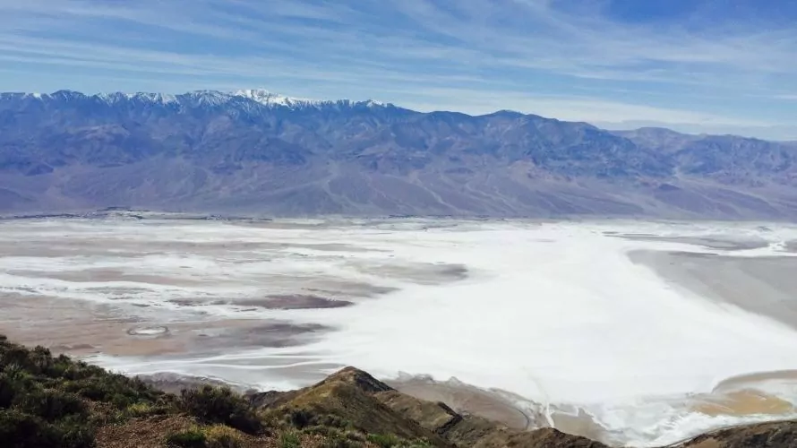
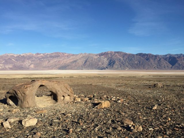
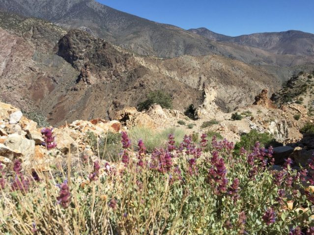
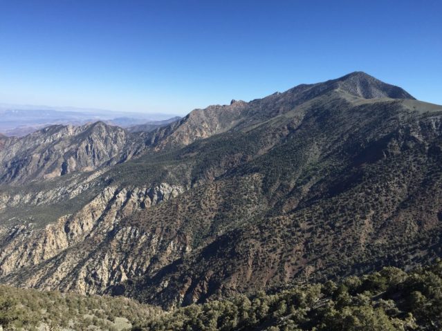
Few hikes or backpacking trips on the planet journey through so many distinct landscapes in such a short span. Starting at the very bottom of North America—Badwater Basin—the ‘Shorty’s Well Route’ begins at 250 feet below sea level in a thicket of thorny mesquite shrubs soaking up the near-poison brine of Death Valley…which is also the hottest place on Earth (measuring 134℉ one July afternoon in 1913). From here, the tree-clad Panamint Range dominates the entire western horizon. Forming a veritable ‘Sky Island’ in the Mojave Desert and sometimes mistaken for the Sierra Nevadas by explorers and pioneers, this surprising Death Valley mountain range is 100 miles long and includes several 8,000ers, 9,000ers, a 10,000er, and the objective: Telescope Peak towering overhead at 11,049 feet.
This route has an elevation gain of over two vertical miles. Or, imagine a Grand Canyon Rim-to-Rim that’s all uphill…and steeper. Nearly all of this route’s 11,300 feet is laid out in a frank display of wonder and pain. As a bird flies, Telescope Peak is less than 13 miles ahead. This dramatic rise in landscape in such a short span gives hikers no chance to acclimate. Any hiker who didn’t just spend days at 9,000+ feet will be gasping for oxygen before adventure’s end.
death valley ‘shorty’
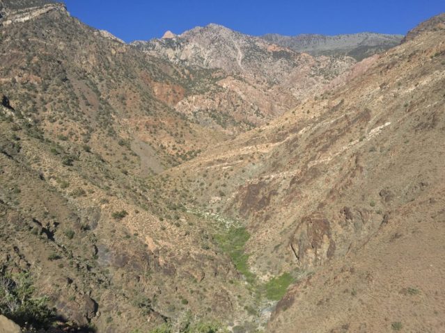
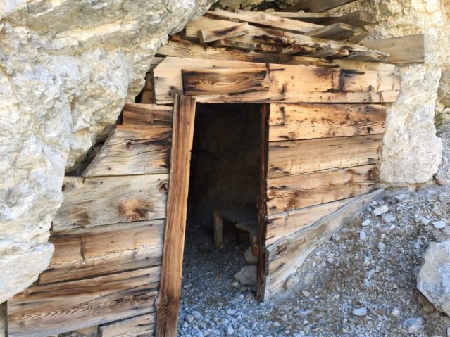
Shorty’s Road—hand dug by 65-year-old mining prospector and Death Valley explorer Alexander ‘Shorty’ Borden in the 1920s—provides an initial trail along a slanted desert feature known as an alluvial fan. These otherworldly landscapes are the churned-up result of glaciers cutting through the Panamint Mountains over countless ice ages. A few notable wind-carved boulders grace the route, exposed to the elements in those same spots for millennia. The road ultimately winds into Hanaupah Canyon and disappears among jumbles of boulders and washes as a casualty to a century of repeated flash flooding. After the first few hours of hiking, the route (no longer a trail) has risen to an elevation of 3,000 feet and within ear-shot of a gurgling spring-fed brook rushing along the canyon floor.
water, hanaupah canyon narrows, and the timbisha shoshone
Springs, especially perennial ones, were and are of absolute necessity to hikers and dwellers of deserts worldwide. In Death Valley, the Timbisha Shoshone Tribe and their ancestors relied on Hanaupah Creek and the several dozen other springs in the region for millennia. Because of the harshness of the environment, the Timbisha were vertical migrators. They lived at the valley floors during the winter and up the cooler mountain slopes as the year grew warmer. In the higher elevations, the Timbisha subsisted on an array of flora and fauna. Pine nuts, prickly pear, mesquite beans, rabbit, big-horn sheep, and deer were common in their diet.
Most hikers stop at the creek to gather water before scrambling out of Hanaupah Canyon onto the mountain ridge. *Note: The park advises not drinking from Hanaupah Creek until a hydrological test can be made due to the presence of man-made toxins. If you plan to explore Hanaupah Canyon, cache water near where you plan to scramble out. Check with the park for further details before planning a trip. See also our blog post on hydration practices. If time allows, explore one or two of Shorty’s mining roads—one of which winds to a colorful copper mine at 7,000 feet. Also begging for exploration are a series of smooth, wet canyon narrows and several springs dotting the canyon’s south fork. These frolics would take you out of your way if you’re aiming for Telescope Peak, but this is the time for adventure (which is the real objective here, anyway!).
transitioning mountainscape
After exploring the canyon, there is still the mountain to be climbed. Backpackers who crave route-finding will relish the next stages of this trip. There are several ways up onto the east-west ridgeline above Hanaupah Canyon—some easier (and less dangerous) than others—and I won’t spoil that decision here. (Michel Digonnet’s Hiking Death Valley is available for those who want to research this route thoroughly). Once onto the sloped ridgeline, scattered juniper and pinyon appear as the biome transitions from desert to a type of woodland colloquially known in the American West as The PJ: a tree combination that craves both dry air and the moderate precipitation afforded by the higher, cooler atmosphere. These tough trees can withstand droughts as well as snow, and often find extremes of both in the high ranges in Death Valley National Park.
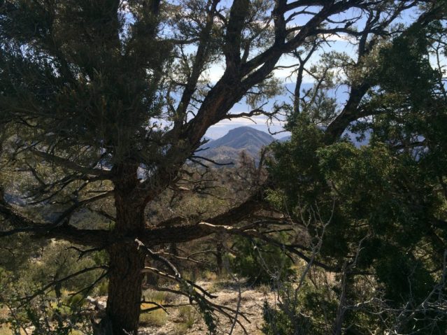
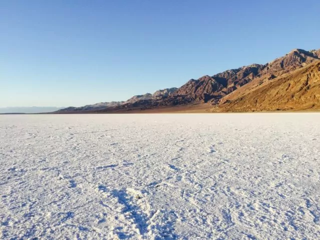
As the route leads to elevations of 7,000 feet, more and more pinyons are encountered. By 8,000 feet, it’s a forest hike, with the entire field of vision filled with pinyon pines and juniper. A blanket of pine cones covers the ever-slanted ground like snow. Take breaks, gather pine nuts, and look back through slivers of pine to the vast salt flats of Badwater Basin. Badwater now appears as a massive, creamy swirl looking more like a feature of Tatooine or Mordor than Earth. And, camping on a clear night along the ridgeline, or nearly anywhere else in Death Valley, will display some of the most brilliant stars and planets in the country.
home stretch
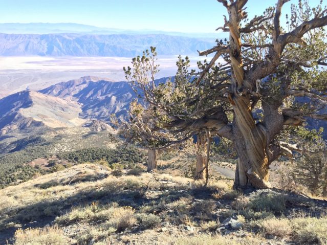
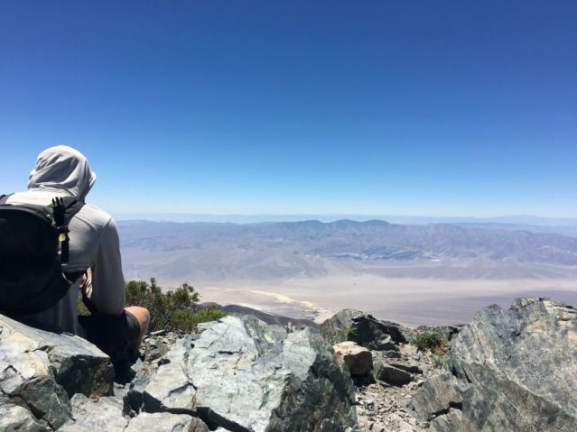
With the sky growing larger, the final push to the main north-south ridgeline is an air-gasping slog up a vertical meadowland, dotted with red, purple, and yellow wildflowers, the many-shaped limber pine, and the twisted and ancient bristlecone pines, many of which are several thousand years old. *Be wary of hiking this route in the winter or spring. A heavy snow pack makes this route much, much more difficult and dangerous. Eventually, in a moment of euphoric accomplishment, the route ends at Telescope Peak Trail. A short distance south leads to the first view to the west horizon. This wondrous panorama includes Panamint Valley 9,000 feet below, the Argus Range, and the Sierra Nevada Mountains. Two miles up the trail, that 11,049-foot objective awaits.
the peak
The summit of Telescope Peak is a place to sit and witness the enormity of the West’s fractured and beautiful landscape—a hiker’s throne to gaze upon the seemingly endless tracts of mountains and valleys of California and Nevada, from the fabled Sierras (and Mount Whitney) to Mount Charleston over Las Vegas. The views are absolutely spectacular.
Compared to the ascent, the seven-mile descent on the Telescope Peak Trail feels like more of a long walk. The northward path follows along the vista-filled ridge of the Panamint Range before turning east at Arcane Meadows and finally winding along the side of the 9,960’ Rogers Peak (the etymology of which, and several other Death Valley landmarks such as Manly Beacon and Bennett Peak, is an epic tale). The trail ends at Mahogany Flats campground at 8,000 feet (also a highly recommended campsite if water and supplies allow). By the end, you will have experienced the ultimate Death Valley hiking tour—a rewarding, grueling, exhilarating, and aching L2H trek up an 11,300-foot vertical cross section of wild.
Death Valley National Park is one of America’s great secrets, and a paradise for hikers, naturalists, and Old West enthusiasts. See also Traci Salisbury’s Keep Death Valley Weird and Peter Rognli’s Four Things We Love About Death Valley National Park blog posts.

