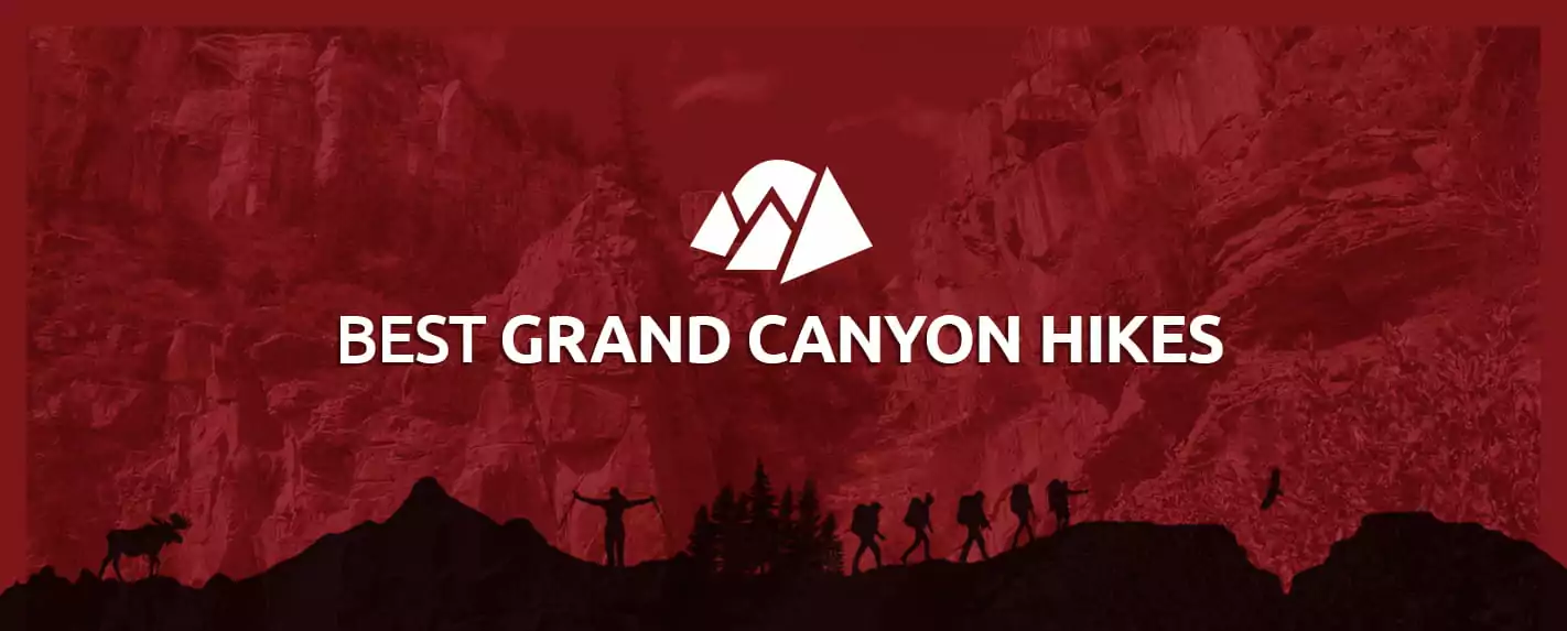
Best Hikes in Grand Canyon National Park
Learn about our recommended hiking trails and hikes in the Grand Canyon.
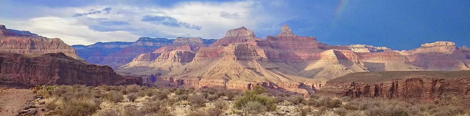
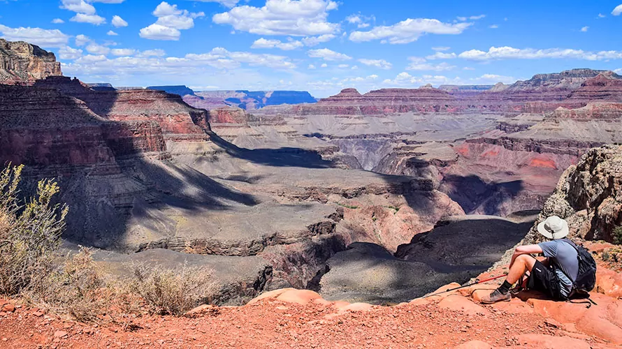
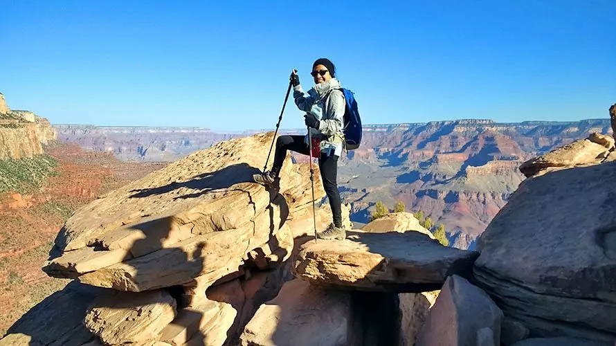
The Grand Canyon is one of the most renowned hiking destinations in the world. From leisurely flat strolls along the rim to more strenuous hikes that descend dramatically into the canyon, this park offers something for every hiker. However, simply opening up a trail map and searching for a good hike can be overwhelming, which is why we’ve compiled this handy list of the best hikes in the Grand Canyon.
BEST NORTH RIM HIKES
The rugged, remote North Rim of the Grand Canyon is only open from May 15 to September 15 and offers fewer activities, tours and lodging options than the South Rim. It is precisely for these reasons, however, that certain hikers prefer it — the North Rim is significantly less crowded and is an excellent choice for those wanting a more natural, quieter experience. Here are four of the North Rim’s best hikes.
NORTH KAIBAB TRAIL
The North Kaibab Trail forms the upper half of the famous Rim to Rim Trail and offers visitors breathtaking views as they make their way down to the Colorado River. Just 0.75 miles into the hike is the Coconino Overlook, which allows visitors to appreciate beauty and immensity of the canyon. The Supai Tunnel, which is 2 miles down the trail, offers similarly beautiful vistas. This well-shaded trail is 9.30 miles in length and features a 3,907-foot elevation gain. It is also one of the best day hikes in the Grand Canyon. We recommend day hikers turn around at Roaring Springs.
BRIGHT ANGEL POINT TRAIL
One of the best short hikes in the Grand Canyon, the trail leading to Bright Angel Point is a great way to start your exploration of the North Rim. With a net elevation gain of only 108 feet, this easy trail allows you to take in stunning panoramic views without too much physical exertion. Bright Angel Point is also the North Rim’s central hub for lodging and information.
CAPE FINAL TRAIL
The two-mile Cape Final Trail leads to the Walhalla Plateau’s most eastern point and offers fantastic views of the Jupiter Temple and Vishnu Temple. This trail is considered one of the North Rim’s best hikes, and with only 150 feet of elevation change, it’s quite easy on the knees. It’s also an excellent choice for visitors wanting some solitude, as the trail’s remote location means crowds are minimal.
This enchanting trail starts at Cape Royal Road, passes through a forest of ponderosa pines, then meanders through pinyon pines and cacti. Camping is a possibility at Cape Final, although keep in mind that only one camping permit is granted per night.
RAINBOW RIM TRAIL
This 18-mile, easy/intermediate trail connects five major points on the North Rim: Timp, North Timp, Locust, Fence and Parissawampitts. From each peak, visitors can enjoy different views of Steamboat Mountain, Powell Plateau, Great Thumb Mesas, Tapeats Amphitheater and various other stunning natural features.
The route also winds through an old growth forest of Ponderosa pines, as well as canyons full of aspen groves and meadows. Although this trail features an elevation change of 3100 feet, it is mostly smooth, making it suitable for bikes.
BEST SOUTH RIM HIKES
The South Rim attracts an impressive four million visitors every year and is open year round. In addition to its breathtaking views, it also offers a wide variety of accommodations, services, tours and cultural attractions. If you’re planning on hiking the South Rim, consider one of the following five hikes.
SOUTH KAIBAB TRAIL
The South Kaibab Trail is, along with the Bright Angel Trail, one of the South Rim’s two maintained trails. The South Kaibab Trail is the more difficult of the two, which is due to factors including steepness and a lack of shade and water. The trail descends 4820 feet in elevation over 6.5 miles, and because of this steep incline, hikers should plan to take twice as much time hiking up the trail as hiking down.
The trail starts by going into a ravine, but the walls quickly open out, revealing unforgettable views in both directions. After hiking for 1.5 miles and descending 945 feet in elevation, hikers can stop for a bathroom break at Cedar Ridge, which offers fantastic views and is a recommended turnaround point for those doing a half-day hike.
The trail then descends steadily to O’Neill Butte and, after many switchbacks, reaches the Tonto Plateau at the four-mile marker. The route then becomes more flat and passes The Tip Off, which lies above the Inner Canyon Gorge and has an emergency phone and bathrooms.
The final section of the trail becomes steep once again, particularly the section right above the Colorado River, which can be seen throughout the final mile of the trail. After passing through a tunnel, the trail ends as it leads onto a suspension bridge. Shortly after traversing the bridge, hikers arrive at the Phantom Ranch, which includes a campsite, a guest house, mule stables, a ranger station, an emergency phone and various other amenities. From here, hikers can continue to the North Kaibab Trail, which leads to the North Rim.
The trailhead is on Taki Point Road just south of Yaki Point, which you can only reach by shuttle bus. While there is no drinking water available along the trail itself, it is available at the trailhead year-round.
Explore Grand Canyon with Award Winning Guides

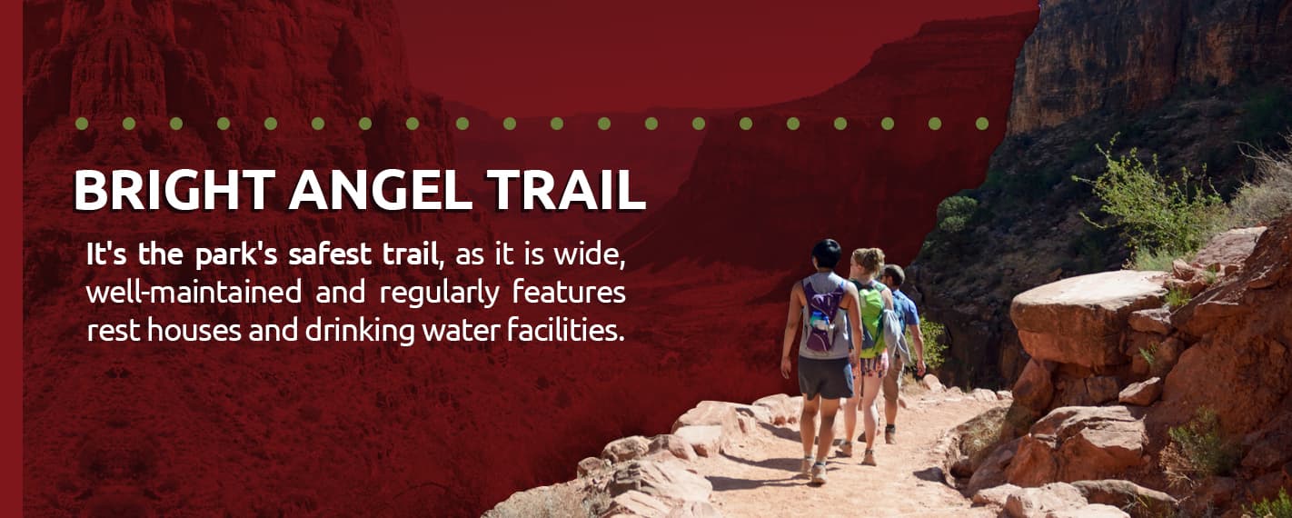
BRIGHT ANGEL TRAIL
The Bright Angel Trail is thought by many to be the best hiking trail in the park. It travels along a break formed by the Bright Angel Fault and roughly follows a path used by various Native American groups for thousands of years. The trail was first built in 1891 to access mining claims and has been managed by the National Park Service since 1928.
It’s also the park’s safest trail, as it is wide, well-maintained and regularly features rest houses and drinking water facilities. First-time visitors to the park often hike this trail together with the South Kaibab Trail, usually choosing to ascend via the Bright Angel Trail due to the shade, drinking water and emergency phones available. There are two ranger stations on the trail.
The trail starts next to Kolb’s Studio, which is located to the west of the Bright Angel Lodge. Early stops along the trail are the 1.5 Mile Resthouse and the 3 Mile Resthouse, both of which are good targets for day hikers. At Havasupai Garden, the path’s halfway point, visitors can take a spur trail nearby that goes to Plateau Point, one of the park’s most gorgeous vistas and another good turnaround point for day hikers.
After passing Havasupai Garden, the route descends steeply to the Colorado River, passing Vishnu Schist along the way and ending where it leads onto the Bright Angel Suspension Bridge. After crossing the bridge, visitors will soon pass the Bright Angel Campground and Phantom Ranch.
The trail is 9.5 miles long and descends more than 4000 feet in elevation. Some visitors choose to travel this trail on a mule, which you must book many months in advance.
GRANDVIEW TRAIL
This strenuous, rocky, exposed trail features sheer drop-offs and is not for the acrophobic. During the winter and early spring, upper sections of the trail can also be icy, so make sure to bring over-the-shoe traction devices if traveling the trail during the colder months of the year.
The trail is narrow, steep in some places and maintained only intermittently. However, the route is nonetheless rather popular, particularly Coconino Saddle, a viewpoint located 1.1 miles down the trail, beyond which few hikers continue.
Three miles down the trail is the Horseshoe Mesa, which has an undeveloped camping area and old copper mines, where many day trippers choose to turn around. At this point, the Grandview Trail splits into three separate trails that descend roughly 1000 feet and intersect with the Tonto Trail, which runs east-west and parallels the river for more than 100 miles. Unlike the South Kaibab Trail and Bright Angel Trail, the Grandview Trail does not reach the Colorado River, although visitors taking this trail can still access the river by continuing onto other trails.
To access the trailhead for the Grandview Trail, visitors must take the South Rim Drive east from Yaki Point. After passing South Kaibab Trail, they’ll see a sign for the trail.
HERMIT TRAIL
This trail is one of the six routes that run from the South Rim to the Colorado River and is known for the variety of its scenery, which includes gorges, waterfalls and broad, open landscapes. The Hermit Trail is less crowded than the South Kaibab and Bright Angel trails.
Although considered an intermediate hike, this trail is 9 miles long and has an elevation change of 4340 feet, making it somewhat strenuous and is not recommended as a day hike. Most hikers spend the night at the Hermit Creek Campground, a less developed facility not far from the Colorado River. Reservations must be made months in advance.
RIM TRAIL
The Rim Trail is a 13-mile trail that starts at Hermits Rest and works its way east to the South Kaibab Trailhead. Although rather long, this trail is exceptionally flat — instead of descending into the canyon, it runs along the South Rim, allowing visitors to enjoy amazing views without the switchbacks and steep inclines. If you don’t have the desire or ability to tackle one of the strenuous hikes inside the canyon, the Rim Trail is a great alternative. Furthermore, you don’t have to walk the entire distance. There are shuttle bus stops all along the trail, meaning you can get to any point along the trail without having to walk very far.
The trail can be divided into several segments:
- Pipe Creek Vista to Bright Angel Lodge: This section has several parts that are steep enough to exceed accessibility standards.
- Bright Angel Lodge to Powell Point: After Bright Angel Lodge, the trail becomes narrower, follows the Bright Angel Fault and begins to parallel Hermit Road.
- Powell Point to Monument Creek Vista: This segment of the trail consists of a dirt path three feet wide.
- Monument Creek Vista to Hermits Rest: This mostly paved section is also called the Hermit Road Greenway Trail.
You can also enjoy a variety of attractions along the trail, including:
- The Trail of Time: This 1.3-mile segment features samples from each rock layer with age markers, helping visitors appreciate the vast geologic history of the canyon.
- Yavapai Museum of Geology: This fascinating museum teaches visitors about the formation of the canyon. Restrooms and water are also available.
- Maricopa Point: At this vista, visitors can check out old equipment from a uranium mine while taking in magnificent views.
- Bright Angel Trailhead/Village Route Transfer: Here, tourists can visit many historic buildings, such as the Hopi House, the Kolb Studio, El Tovar and the Bright Angel Lodge.
RIM TO RIM TRAIL
If you can’t decide which rim to pick, why not do both? This legendary 24-mile trail allows visitors to hike from one rim of the canyon to the other and is a bucket list challenge for hikers around the world. Visitors can choose to traverse the canyon by starting at either rim and can also choose between two trails for the Southern portion of the journey. Although you can complete the hike in a single day, many hikers prefer to spend the night along the way. If you’re starting at the North Rim, you will gradually descend into the canyon on the North Kaibab trail, where you’ll pass through eleven layers of ancient rocks that show two billion years of geologic history. You will eventually reach the Colorado River, where dozens of gigantic rock formations tower above you. Here, you can stay at the Phantom Ranch to enjoy a refreshing drink, a warm meal and a comfy bed.
Next, you can choose to ascend up the steeper South side of the canyon on either the Bright Angel Trail or the South Kaibab Trail. The Bright Angel trail is thought to be the park’s best trail, although it is the longer of the two options. However, it also offers frequent shade and water — depending on the time of year — making it an overall more pleasant experience for most visitors.
Upon completing the Rim to Rim hike, visitors can take a much-appreciated shuttle ride back to where they started.

BOOK A GUIDED TOUR WITH WILDLAND TREKKING
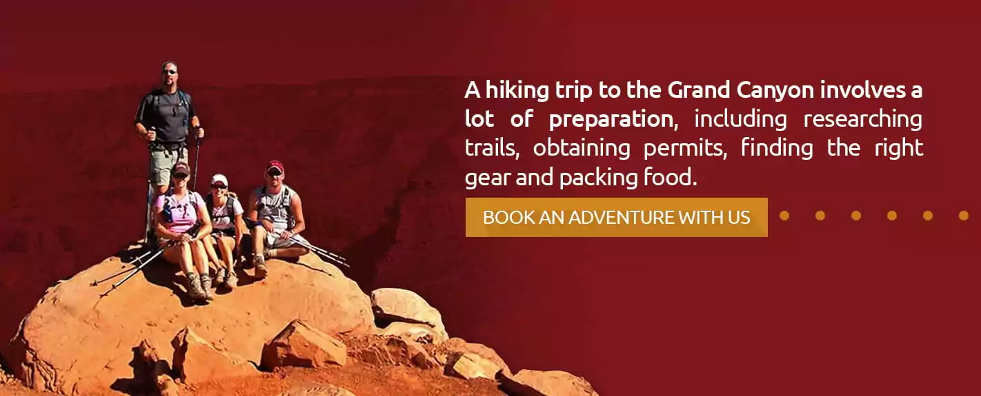
A hiking trip to the Grand Canyon involves a lot of preparation, including researching trails, obtaining permits, finding the right gear and packing food.
If you book a guided hike with Wildland Trekking — however, you won’t have to worry about any of these things. We’ll take you on only the best hikes, take care of the permits and provide you with appropriate gear and delicious meals. With all these burdens eliminated, you can focus more on enjoying your hike and the spectacular nature around you.
On review sites such as Trip Advisor, guests regu
Related Pages